Treetop Counting in Tropical Forest
The final work for my Image Processing graduate course at ICMC. Done in collaboration with the UFRRJ Forest Engineering department’s Bruno Mendonça and Fernando Canto.
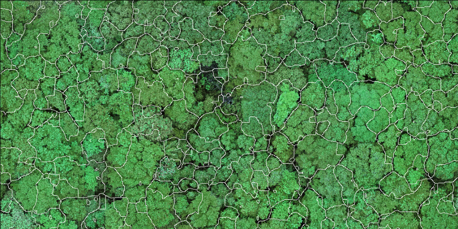
The main objective of this ongoing work is to segment drone-captured images of native forests into individual tree crowns. The main desired output is a simple counting of the trees, but any successful segmentation will also provide spatial data such as perimeter, area and altitude. This last one is possible because a 3d representation of the area is also available.
The specific images for this experiment are of a green area within the UFRRJ campus. Please visit the project’s GitHub page for a full explanation and working Jupyter Notebook. Code is all in Python, using OpenCV and Numpy.